Space imaging
Hyperspectral Imaging
Radar Imaging (SRS)
Perfect for environmental monitoring, vegetation condition classification, categorization of artificial and natural materials, fire detection, mapping, and much more.
Consistent, high-quality, all-weather data. Analysis of terrain and structural deformations.
Construction, geological exploration of territories, and research.
Construction, geological exploration of territories, and research.
Satellite imagery provides essential context and visualization of ground conditions


We provide remote sensing data of the Earth's surface with any available parameters for any territory.
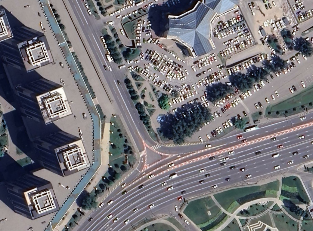
Optical images with resolution up to 0.3 m per pixel:
Medium resolution optical images 1-5 m:
Radar images:
Hyperspectral images:
Stereo pairs for creating 3D terrain models:
- Modern satellites provide high image clarity and geolocation accuracy.
- Guarantees maximum imaging efficiency and data update frequency.
- Cost-effective solutions optimal for most practical tasks.
Medium resolution optical images 1-5 m:
- Proven satellites with wide coverage are ideal for monitoring vast territories.
- Budget satellites suitable for overview purposes.
Radar images:
- Guarantee all-weather interferometric imaging with detail up to 0.5 m.
Hyperspectral images:
- The only option to obtain maximum information about the surveyed territory.
Stereo pairs for creating 3D terrain models:
- Satellite stereo data allows creation of ultra-high resolution DEMs.
CONTACT US
Send us your message
Call us
Click on the QR code or scan it to save the contact in your phone.
